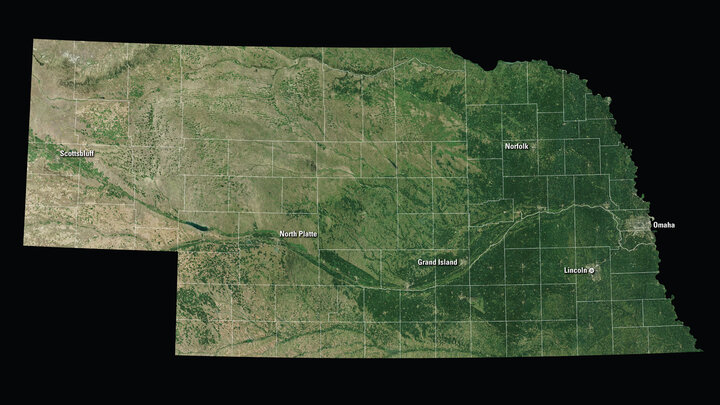
Landsat 8 Mosaic of Nebraska

USGS EROS Data Center Landsat 8 mosaic of Nebraska.
Remote Sensing Imagery and Data Viewers
EarthExplorer provides online search, browse display, metadata export, and data download for earth science data from the archives of the U.S. Geological Survey (USGS).
Nebraska Digital Raster Graphics (DRGs) can be downloaded for free from the University of Nebraska, School of Natural Resources.
GloVis (Global Visualization) is a U.S. Geological Survey (USGS) web tool that provides search, display, and download of remote sensing data.
NOAA View is a data viewer from the National Oceanic and Atmospheric Administration (NOAA) that allows users to visualize numerous environmental variables at various temporal spans across the globe. The tool uses data from NOAA’s vast archives of satellites, climate models, and the NOAA Ocean Atlas.
LandsatLook is a U.S. Geological Survey (USGS) tool that allows rapid online viewing and access to the USGS Landsat Collection 2 data.
Google's Landsat Annual Timelapse viewer is an interactive video that allows a user to pan and zoom anywhere on Earth and view annual mosaics from 1984 to the present at the resolution of a Landsat pixel. Users can create custom views of their own areas of interest by zooming to a particular view, and then clicking the "Share this view" button, which produces a custom URL that you can send to anyone.
Nebraska Geospatial Data

University of Nebraska–Lincoln, School of Natural Resources Geospatial Data

NebraskaMAP provides public and private access to peer-reviewed Nebraska Spatial Data Infrastructure (NESDI) and other statewide geodata, maps, and GIS web services for Nebraska. https://www.NebraskaMAP.gov/

The Nebraska Department of Natural Resources Data Bank.
Open-Source Landsat 8 Processing Tools
MapBox has developed a process that allows the user to create an interactive map from Landsat 8 imagery using free open-source image-processing and map-making tools. Step-by-step instructions are available at https://blog.mapbox.com/processing-landsat-8-using-open-source-tools-d1c40d442263.
